13 April 2024
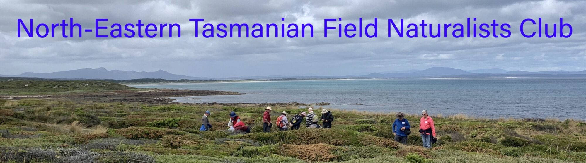
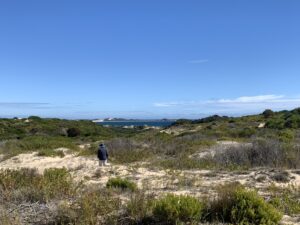
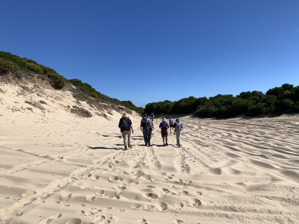
The North-Eastern Tasmanian Field Naturalists Club recently held a walk into the Double Sandy Point Conservation Area near Bridport. Club members walked from the east side to the west side of East Sandy Point following the first part of the Bridport to Bellingham 4WD Traverse over the dunes. The walk covered a distance of about 10 km, most of it along the sandy 4WD track.
The dunes were likely formed during, and for a period following, the flooding of Bass Strait, with the major accumulation of sand from the Bassian Plain complete around 3,000 years ago. Over time, the dunes stabilised and were vegetated. However, the early European settlers used the vegetated dunes across much of the northeast as grazing runs. Land management practices poorly suited to the area resulted in degradation of the dunes, and by the 1950s and 1960s sand was moving from the East Sandy Point dunes into Anderson Bay. The longshore current transported the sand to Bridport where it regenerated the beaches, but caused navigation problems for boats attempting to reach the wharf.
Click a photo for a great view
-
- East Sandy Point (PR)
-
- East Sandy Point (PR)
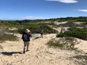
Marram grass (Ammophila arenaria) – an introduced species – was planted during the 1980s and 1990s to stabilise the dunes. During the field naturalists’ visit to the Conservation Area, no marram grass was observed, however those members who had visited the dunes around the time of the marram grass plantings remarked on the significant increase in native vegetation, such as Banksia, Allocasuarina and Acacia, since then. The dunes have largely stabilised, although there was clear evidence of 4WD activity beyond the marked track, risking destabilisation of some fragile dune areas.
The field naturalists were on the lookout for fungi growing in the sand of the dunes, an unusual place for fungi to grow. Although they were seen there last year, disappointingly, none were sighted this time. Sand dunes are a great place to see animal tracks, and a wide range were observed on the day, from wombats, to lizards and beetles.
Club members were pleased to find that there were many examples of rhizoliths at several locations. Rhizoliths are formed when the roots of shrubs and trees become encased in calcium carbonate derived from sea shell fragments. The plants eventually die, but the encased roots can remain hidden under the sand of the dunes for thousands of years. Deflation of parts of the dune, typically by strong winds, can expose the rhizoliths to be found by future generations of dune explorers.
-
- Ross among the rhizoliths
-
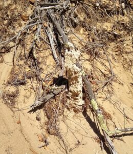
- Rhizolith, East Sandy Point (LR)
Material found at one of the dune sites reminded us that long before cattle farmers, four wheel drivers and field naturalists explored the dunes, generations of the first Australians called the area home.
Plans to have lunch on the beach where the 4WD traverse emerges at St Albans Bay were abandoned when the wind threatened to coat our lunches with a fine layer of sand. We moved back behind the foredunes and enjoyed lunch in a sunny sheltered spot. The trek back out to the beginning of the track seemed a bit longer than the walk in, but spirits were high and the weather could not have been better. A day well spent and enjoyed.
Ross Coad
-
- East Sandy Point (PR)