
Revel Munro led the Field Nats and their friends from the St Helens Walking Group on a fascinating and varied hike from the disused Moorina Power Station to the Frome Dam.
After leaving the cars nearby and organizing a car shuttle, it was a pleasant walk to the power station through wet sclerophyl forest, passing a regenerated coupe on our left, with another one on the hill opposite showing good regeneration.
We explored three derelict houses once occupied by workers at the power station. The third one was in reasonable condition – it looked as though someone was looking after it.
(Click to see the photos in their full splendour)
-
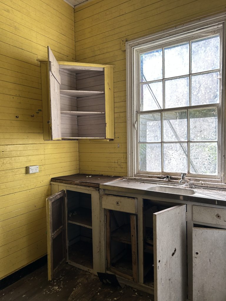
- Derelict house, Moorina (PR)
-
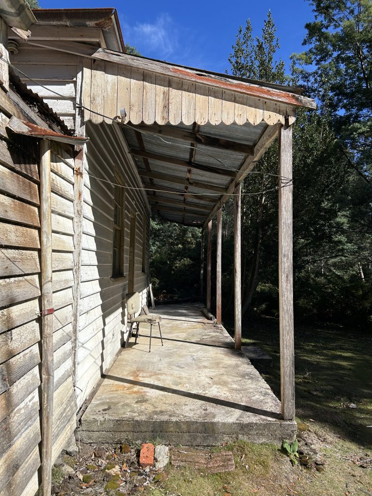
- Derelict house, Moorina (PR)
-
- Moorina Power Station today (PR)
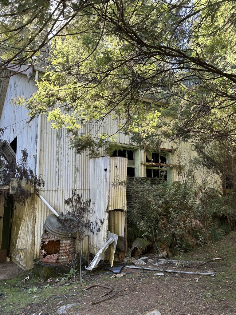
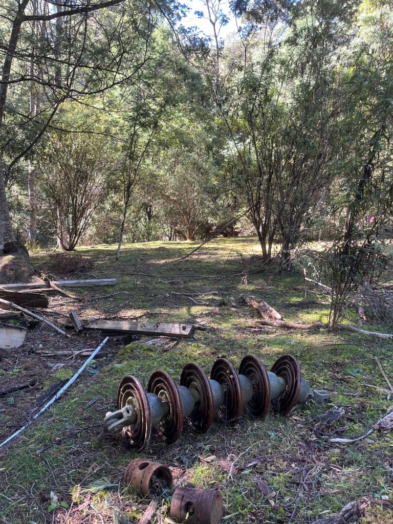
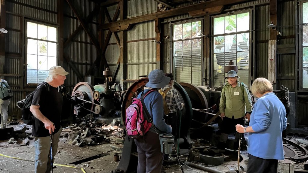
Then on to the power station which was a disaster after copper thieves had been there around 18 months ago. Here are some images I took in 2006 when it was still operational.
-
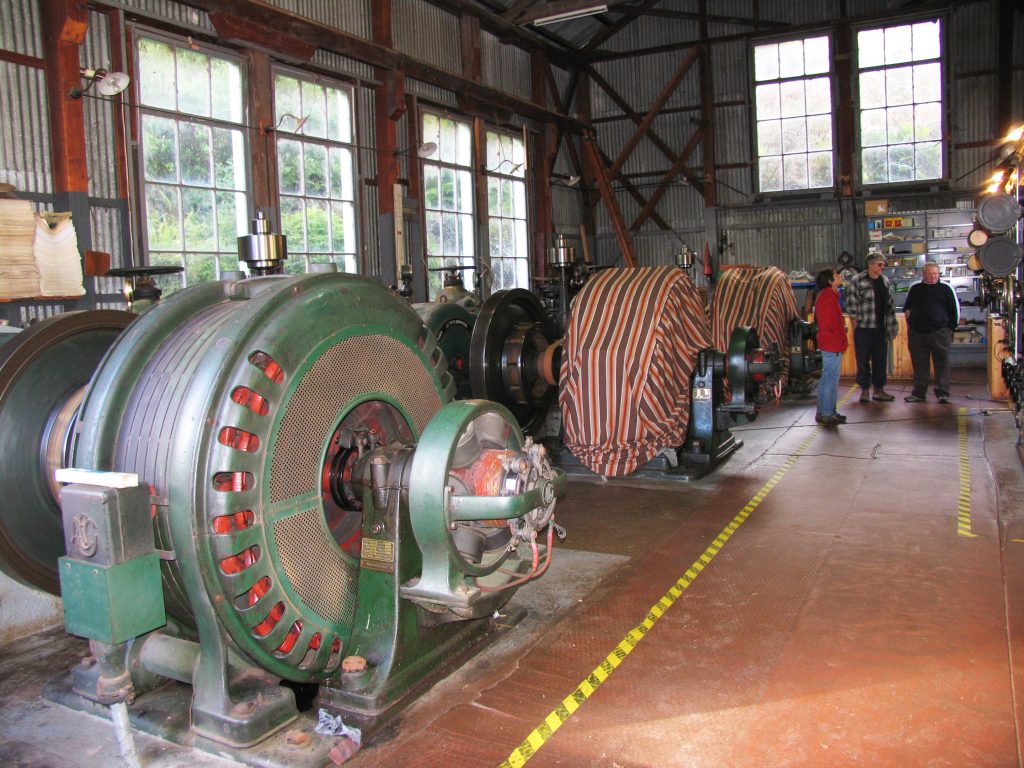
- Moorina Power Station in 2006 (GR)
-
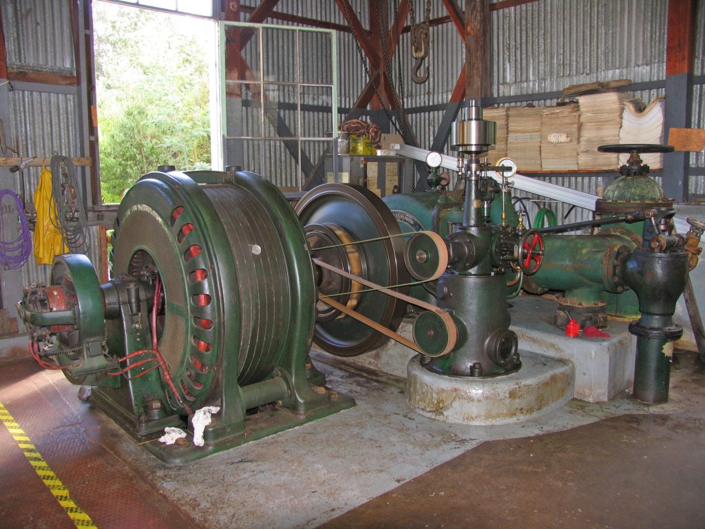
- The Moorina Power Station in 2006 (GR)
-
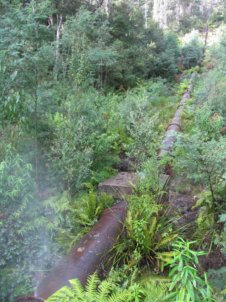
- The pipeline in 2006 (GR)
Below: the recent destruction to the power station.
-
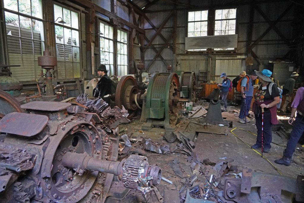
- Destruction of the Moorina power station (GR)
-
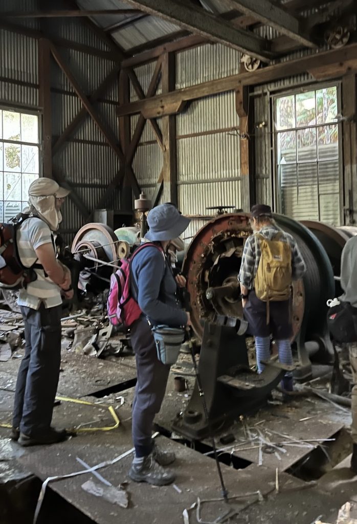
- Destruction of the power station (LR)
-
- Destruction at the Moorina power station (LR)
-
- Destruction of the power station (LR)
Then it was tackling the pipeline. There was no clearing either side of it any more and the track was relatively steep in places, and slippery when sheet rock was just under the surface. We had morning tea halfway up, where Revel and Garry imparted some more knowledge.
-
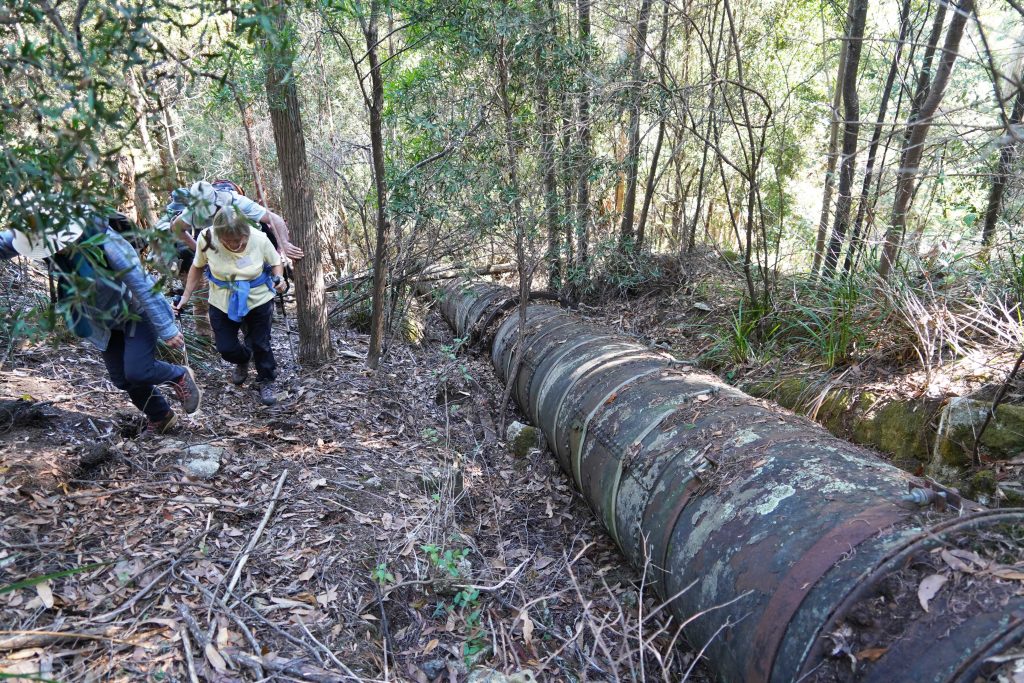
- Tackling the pipeline (GR)
-
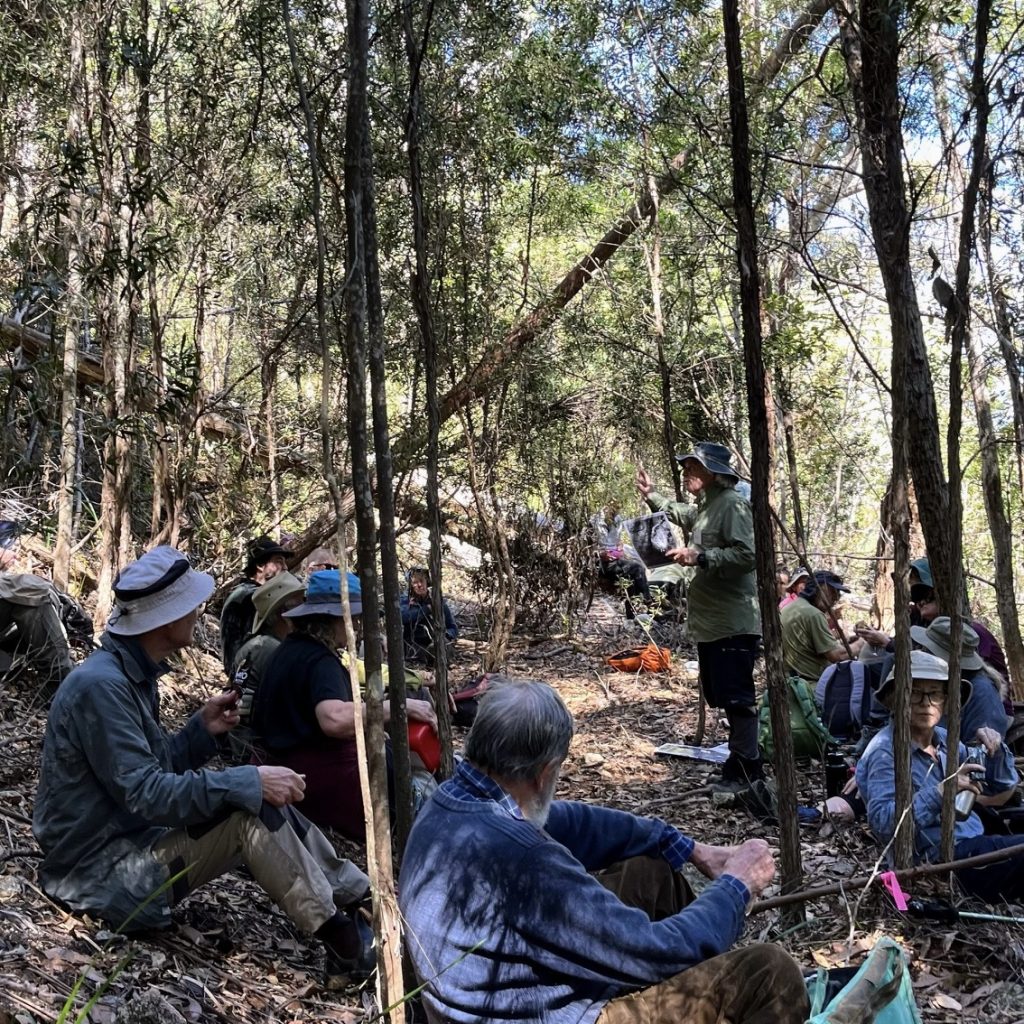
- Morning tea, and knowledge being imparted (LR)
The concrete construction, where the water race met the pipeline, was reached a little while after morning tea, and studied by everyone while Revel explained how it worked.
It was a pleasant level walk along the water race, passing a moss unusual for this area, Dawsonia polytrichoides. Alex said it was probably introduced here by the tin miners or machinery that came in. It is a moss that grows in disturbed ground.
-
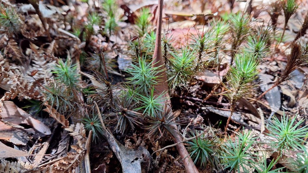
- Dawsonia polytrichoides (CB)
-
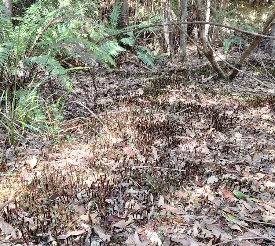
- A meadow of Dawsonia polytrichoides (CB)
Halfway along, the track turned into a road where the pipeline for the Winnaleah Irrigation Scheme was buried. The next stop was the end of the race, where we came across the valve that varied the height of the water in the race. Next to that was the old weir that held the water from the dam that fed the race.
We followed the track to the dam wall where we had lunch, with the fitter members exploring the dam. The water level seemed fairly low – maybe a third its usual depth. The dam was constructed in 1908.
After lunch it was a short walk and a rocky scramble to the end of the dam where there is a headstone for a young worker, Thomas Horsburgh, killed in a mining accident in 1878. Five minutes later we were at yet another derelict house opposite the dam, where the caretaker had lived. This was the end of the walk, and a ride-back vehicle awaited, with more shuttles to follow.
Thank you to Revel, who imparted substantial knowledge about the history and the characters of the area. There was a generous invitation for an après outing get-together at Penny and Lloyd’s which many people accepted. We enjoyed their hospitality.
Garry Richardson, with some input by Lloyd Reeves