Words by Louise Brooker, photos by Jeff Jennings.
The people of Bridport seem to be surprised when they go to the beach and find there’s no sand. Sometimes they don’t even remember a storm that might have caused the sand to disappear. For example, the last significant event was on a very calm, quiet night when the only warning we’d had from the BOM was about particularly high tides in Southern W.A. and across northern Tasmania. The water crept into places it’d never been before eroding the foreshore path, pulling remediation sand bags back into the sea, and encroaching on areas that had never seen saltwater before.
Each time the effects of these events are different depending on the conditions of the time, the state of the tide and the susceptibility of the shoreline: be it sand, soft sediment, soft rock or hard rock.
It was with these observations in mind that the North East Field Naturalists Club recently invited Jeff Jennings to be guest speaker at its AGM. Jeff’s signature approach to the subject “Shifting Sands” was to present a pictorial account beginning with observations of East and West Double Sandy Cape, 5km west of Bridport, made by Bass and Flinders in 1798. Later, in 1879, Reverend Fairley, climbed ‘a mountain of sand’ right on the shore at East Double Sandy Cape.
-
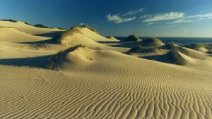
- East DoubleSandy Cape before marram grass planting (JJ)
-
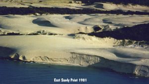
- Before marram grass planting (JJ)
Jeff’s records show sand dunes shifting from the west side of the Cape and dropping into the sea on the shores of Anderson Bay on the east side of the Cape between 1949 and the early 1980’s. These extensive masses of sand moving steadily from west to east prompted the Lands Department of the time to embark on an extensive stabilization scheme which involved the planting of marram grass on the dunes. They did this, believing that the movement of sand from East Double Sandy Cape was the prime cause of the shifting sands on the beaches and at the river’s entrance in nearby Bridport.
-
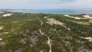
- After marram grass planting (JJ)
-
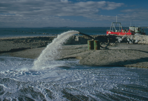
- Pumping sand at river’s entrance 1980’s (JJ)
Despite this huge project, the sand continued its incursion.
There have been many interventions along the coast around Bridport beginning with the building of rock walls to control the direction of flow of the river, the placement of cement walls and huge sand bags to stop erosion, the building of steps and ramps for access to beaches, and the installation of storm water outlets to run across beaches. Pretty much all of them have failed; some have even exacerbated the problems.
-
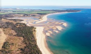
- The ‘delta’of the Little Forester River (JJ)
-
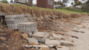
- Croquet Lawn Beach access steps (JJ)
The cause of all this sand movement is what is called the “long shore drift,” where tides and wind-driven currents continually change the character of beaches or estuaries. To understand this continual change, Jeff showed a contrasting series of photos of the Little Forester River ‘delta’ at the end of Adams Beach, where there has been no human intervention at all. The changes wrought by the natural elements there are rather spectacular as well and reflect nature’s propensity for maintaining equilibrium.
We should consider the question “has anything man has ever done made any difference to the problems?”