If we had been standing at Blizzards Landing 20,000 years ago, there would not have been any water in Bass Strait to the north of us. Instead, stretching all the way to Victoria, there would have been the great sandy Bassian Plain. There would have been little vegetation and only a few puddles and ditches. Back then, it was very cold and windy; a most inhospitable place.
Over time, sea levels rose and today there is Bass Strait stretching out before us. The east-west orientated dunes that are part of the present landscape, were formed back then too. They are still visible today, covered with Allocasuarina forests and heathlands. They form what Mike Douglas refers to as a ‘fossilized landscape.’ Mike is leading this Field Nats outing and sharing his knowledge along the way.
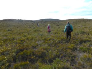
As the group of twenty heads up through the Allocasuarina forest that covers one of those dunes, Mike tells the story of how 20 years ago, the vegetation was burnt by deliberately lit fires. This led to the area becoming protected as a Conservation Area.
The group is privileged to have Ian Thomas along too. Ian’s unusual field is that of paleoecology; he has studied pollen samples from Waterhouse as a way of understanding what the vegetation and the climate was like in the past. He also points out aboriginal artifacts along the way.
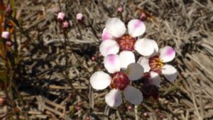
It is an ideal time to visit the heathlands. Along the ridges of the dunes there is an extensive wildflower garden. (NB click on photos to get a better view)
-
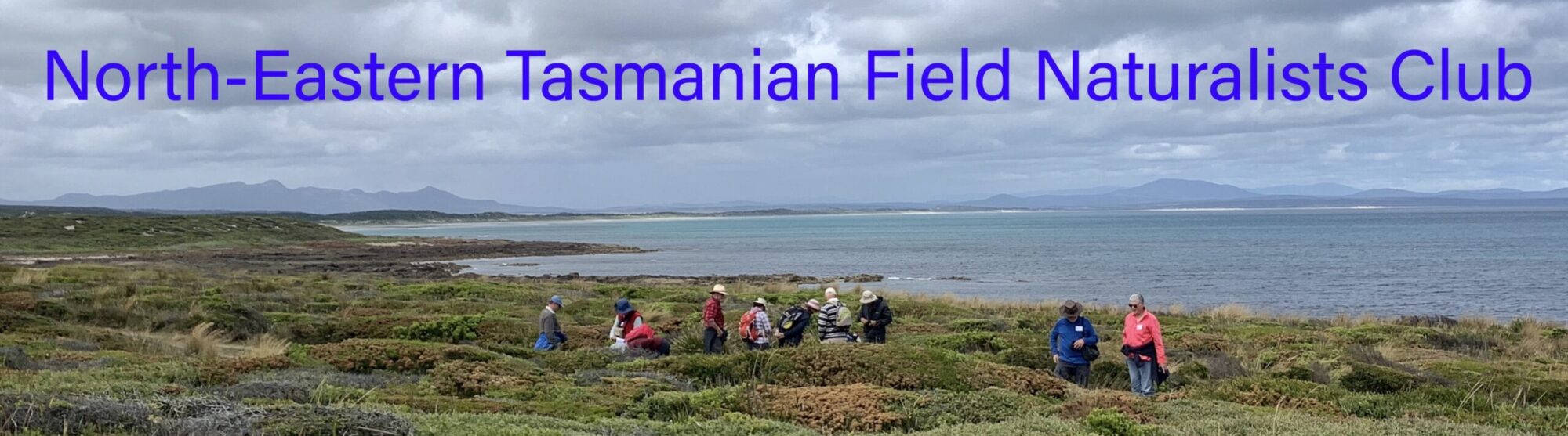
- Silky guinea flower (LB)
-
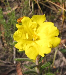
- Rosy baekea (LR)
The rosy baekea is everywhere, a delicate flower with an attractive pink blush on its petals. The native cranberry is coming into flower with a tiny red cigar shaped flower hidden among the prickly leaves. The bright yellow flowers of the silky guinea flower are common. These are just a few of the 400 plant species that are here. It is a really diverse low-growing vegetation, said to be the richest in the state.
-
- On the ridge (LR)
-
- Heading across the heathlands (LB)
As the group walks along the ridgetop there are views of the Mt. Cameron Range, the wild rocky coastline interspersed with sandy beaches and off in the distance is the Musselroe Windfarm.
-
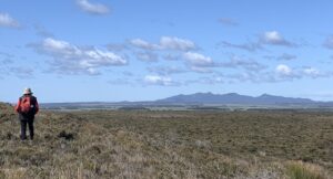
- The Cameron Range seen from the dune top at Waterhouse (PR)
-
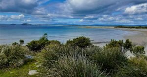
- Ranson’s Beach at the end of the walk (LB).
It is a relief to finish the 6km walk at Ranson’s Beach where shelter from the wind is appreciated.
The Waterhouse Conservation Area is definitely worth a visit at this time of year.
Louise Brooker
Podzol
The inland sand dunes at Waterhouse were formed during the Pleistocene ice age (2.6 million years ago to 10,000 years ago) when Tasmania had extensive glaciation, with alternating warm/cold periods, resulting in the rise and fall of sea levels.
Cold temperatures and a dry windswept environment from the Bassian Plain favoured the formation of dominant heathland or dominant Allocasuarina verticillata (she-oak) forest. These have formed the podzolic soil that we see today. (Click on the photo for a better view)
-
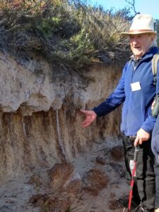
- Ian describes textbook example of podzolic soil profile (LR)
Falling she-oak needles and/or heathlands have formed a dense mat of acid humus as topsoil, with roots penetrating the nutrient-poor sand dunes. The sand enables easy percolation of water and the downward movement of organic matter carrying soluble iron and aluminium. This colours the lower levels, sometimes forming a hard orange iron pan. As it is depleted the upper-most level becomes grey or ash-like.
Podzol is a Russian term, from “pod” meaning under, and “zola” meaning ash-like.
Lloyd Reeves